Terrestrial, Coastal Navigation. Test 3
Terrestrial, Coastal Navigation. Test 3
What is the line roughly following the 180th meridian called?
What is a routeing measure aimed at the separation of opposing streams of traffic by establishing traffic lanes called?
How often is a chart catalogue published?
When must a passage plan be prepared?
In which publication can information on VTS be found?
Where is the title of the navigation chart printed?
Distance on a chart is measured using _____
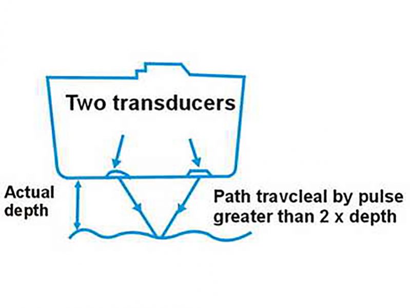
Which error in the echo sounder is illustrated in the diagram?

What should a passage plan include?
Where can you find the symbols and abbreviations used on the Admiralty charts?
Review Answers


